To properly display this page you need a browser with JavaScript support.
TileLogic
TM
Menu
Search
Search
Search
TileLogic MC / MAP
USER INTERFACE
MAPPING Window
MAP SETUP window
MAPPING Tab
← Previous page
Next page →
©
2013, White Barn Tech
TileLogic MC / MAP
OVERVIEW
USER INTERFACE
MAIN window
COMMUNICATIONS PORT SETTINGS window
MAPPING Window
Main & Map Status Bar
BENCH window
SAVE CURRENT LOCATION window
MAP SETUP window
MAPPING Tab
GPS Parameters Tab
Data Location Tab
Display Tab
POI window
CONFIRM AUTO POI window
LAYER Window
LAYER PROPERTIES window
DATA IMPORT window
FIELD NOTES window
TOOLS window
EDITt window
MC MACHINE CONTROL window
Machine Control Status Bar
CONTROL PARAMETERS window
MACHINE CALIBRATION window
CAUTION window
ADVANCED - CONTROLLER INTERFACE window
PROFILE DISPLAY window
SLOPE ONLY DISPLAY window
TOOLBOX window
SCRIPTED SETUP FILES (Advanced)
Protocol.def
TLuser.txt
Tutorials
POI - Using AUTOPOI
LICENSING
License Agreement
How to Register
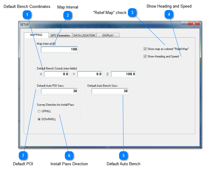
MAPPING Tab
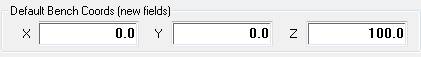
Default Bench Coordinates
Used to define the user's preference for default benchmark coordinate in the the
Bench window
.
Top
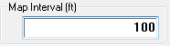
Map Interval
The distance between mapped points. The distance from the previous point at which a new point is automatically recorded.
Top
"Relief Map" check
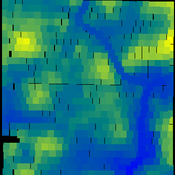
Option for displaying layers with the TOPO style as a tiled and colored "relief map" look or simply points denoted by +.
Top
Show Heading and Speed
Option for displaying heading and speed as reported by the GPS receiver.
Top
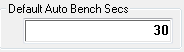
Default Auto Bench
The default timeout value to be used when "Auto Benching".
Top
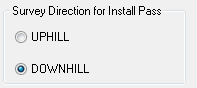
Install Pass Direction
When surveying AWAY from the outlet, select UPHILL, conversely select DOWNHILL.
Tip: Survey install passes are only for use with machine control, and are not normally used for surveying or mapping purposes.
Top
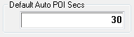
Default POI
The default timeout value to be used when setting an "Auto POI".
Top